It has been a tremendous few days exploring Karijini National Park and driving through the Pilbara region, though it didn’t get off to a very auspicious start. After my night spent outside of Port Hedland, at a free camp right next to a mine, I got up and headed towards Karijini. When I got to the last roadhouse before the park I discovered that the road was closed. Apparently there was a terrible accident, “car vs road train” as one Aussie described it to me, and the cleanup and/or forensics work was ongoing. To make things even trickier, no one had any idea how long the road would be closed, but several days was a distinct possibility.
It was only about 9am and I couldn’t decide what to do. I could just hang out at the roadhouse, in truly the absolute middle of nowhere desert, with nothing to do and 100 degree temperatures for $30 a night. I could go back to Port Hedland, get an alignment, and just kick around. Or I could try the alternate entrance into the park, going across the north and looping around to the west side, which would entail around 90km of dirt road. There was no real risk of getting stuck, and the road sees a fair amount of traffic from the several mines in the area, so it was more a question of whether my van (or my teeth) could handle what might be several hours of bouncing along a corrugated road.
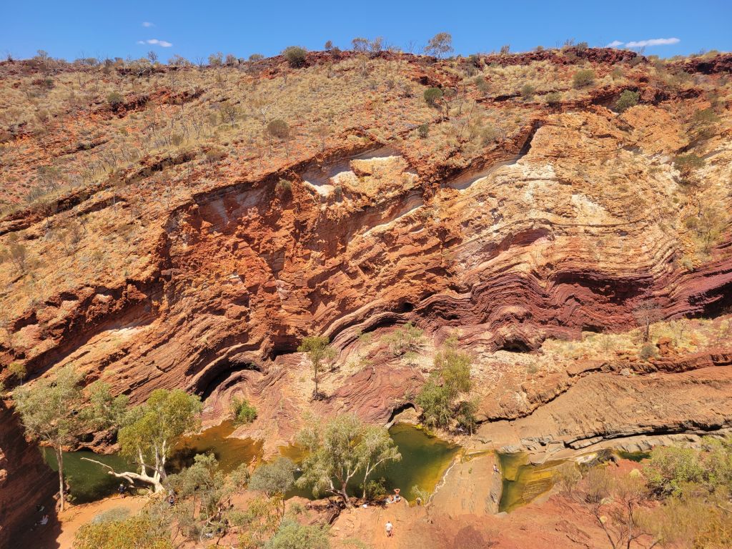
I hemmed and hawed for a long time, chatted with some other travelers, and after hearing from a guy who worked in the area that the road was well maintained and in decent shape, decided to go for it. Good news, he was right! The road was fine and the drive went by pretty quickly. I got to my first stop, Hamersley Gorge, right around lunchtime.
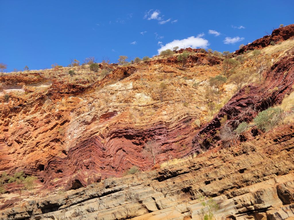
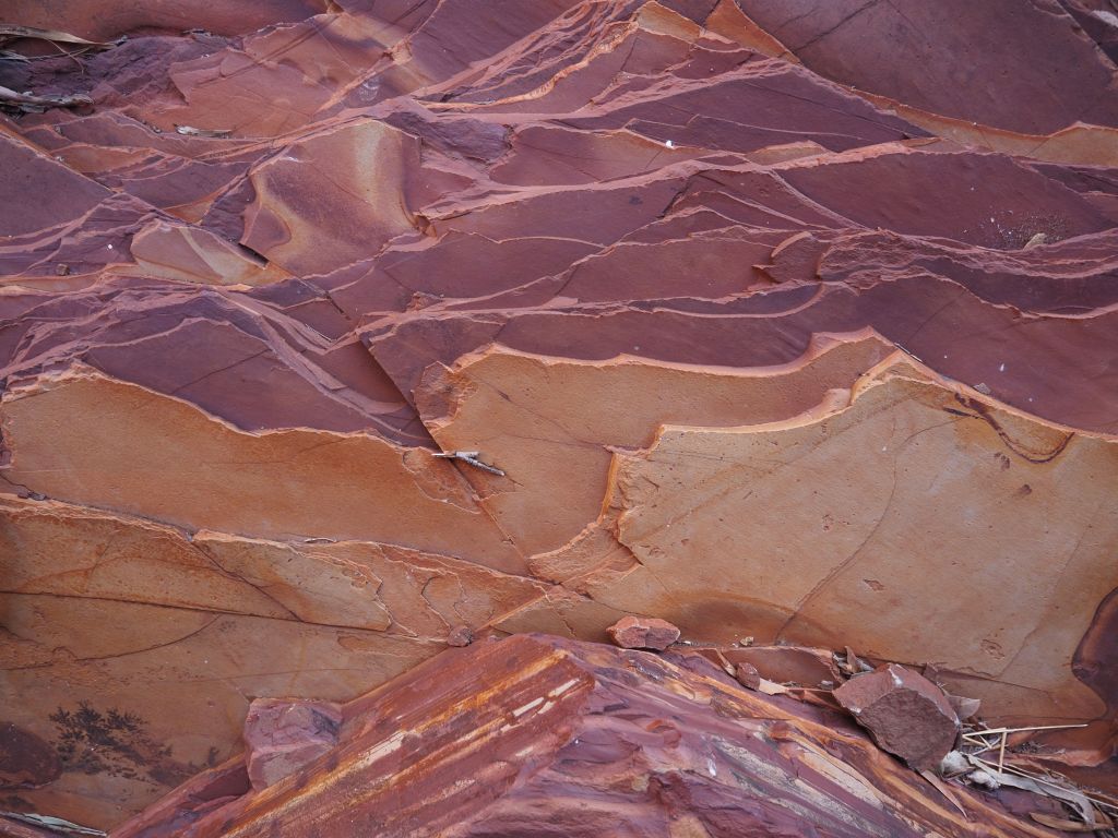
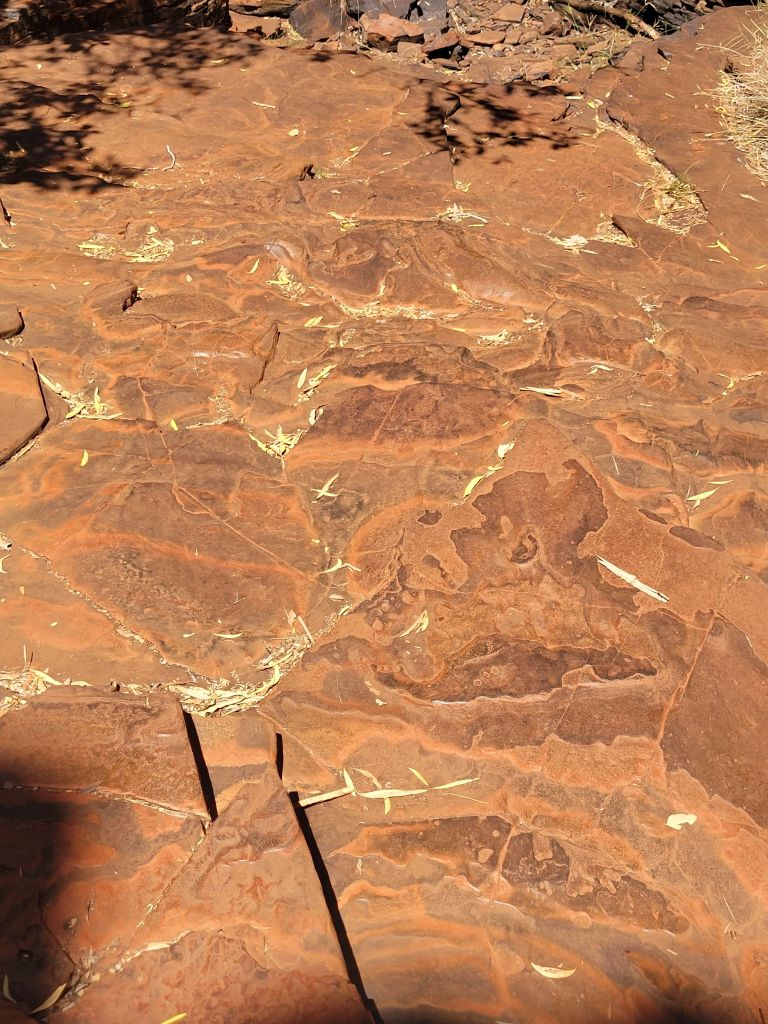
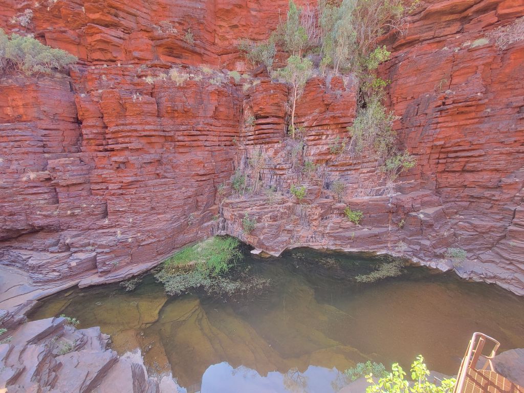
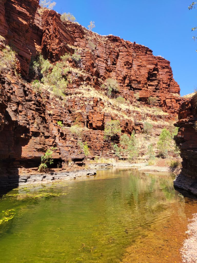
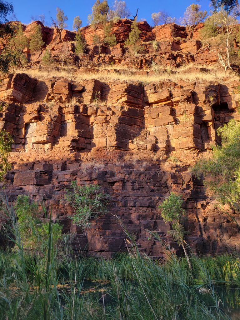
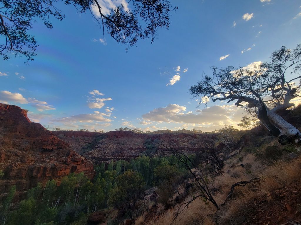
The deal with Karijini, as it turns out, is that it’s a huge area in the middle of an iron-rich desert where there are a collection of deep gorges that the rainwater flows down through. There is also a long geological history along the lines of: ancient seabed, silica and other things filter down and get compacted forming distinct layers, tectonic activity causes the seabed to buckle and lift up, erosion smooths everything back down. The result are these massive gorges where the rock is all stripey, where it’s not just bright red because of the iron, and it is absolutely stunning.
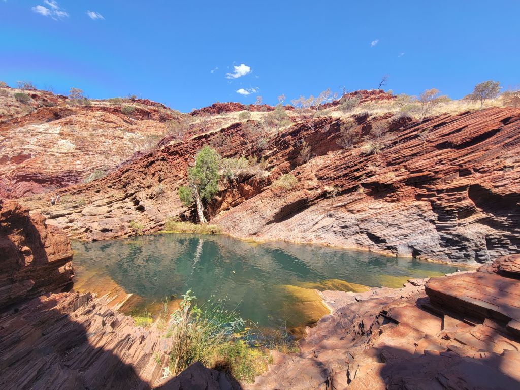
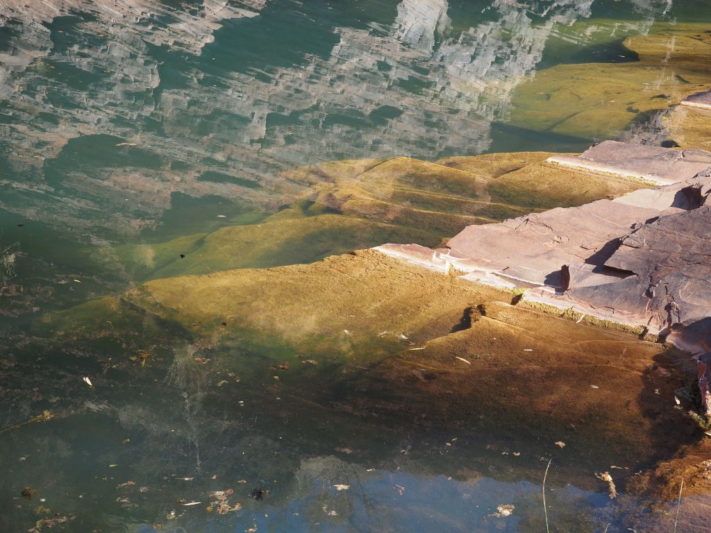
So, first stop Hamersley gorge. Similar to most of the gorges, there was an easily accessible pool, amazing rock walls on either side of the gorge, beautifully carved smaller pools and rock structures, little waterfalls, and lots of fun scrambling to do.


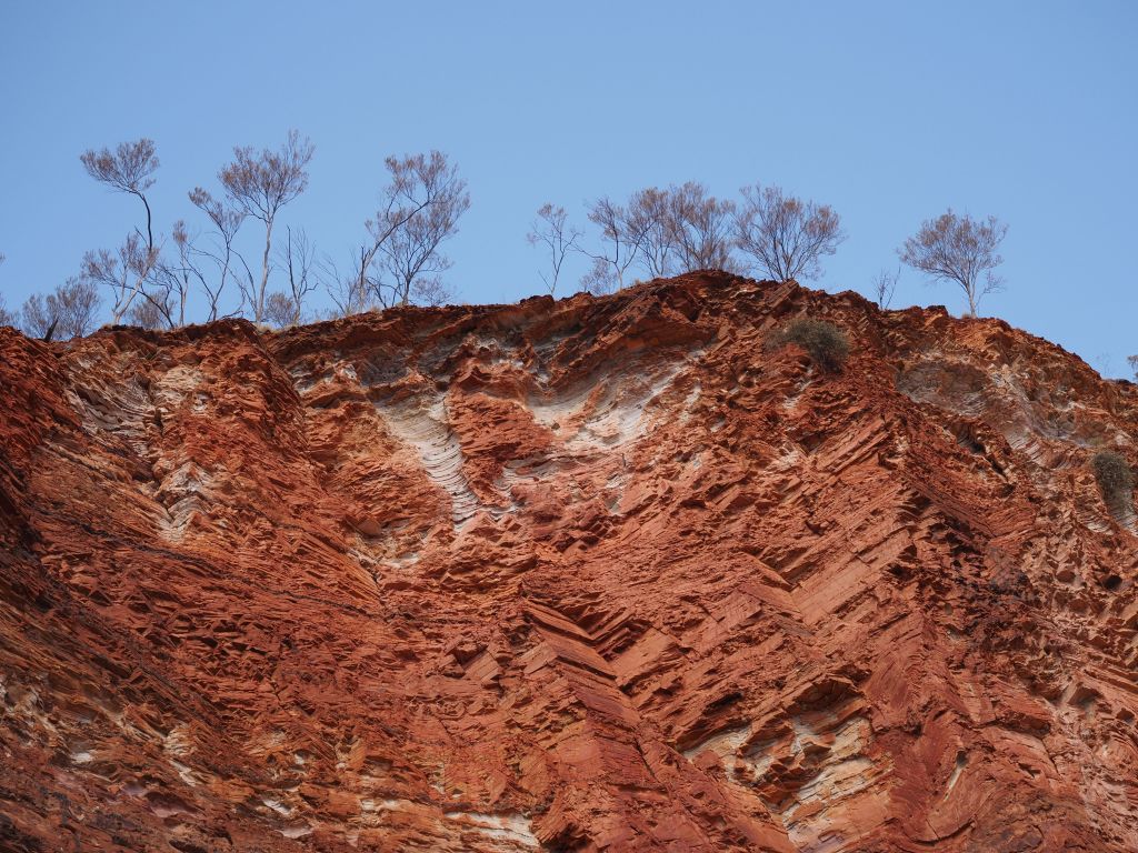


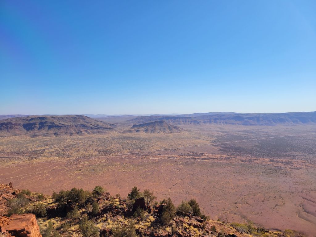
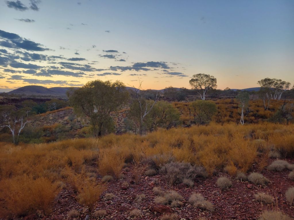
After a couple hours of exploring and taking pictures I drove down to a campsite right next to Mt Bruce, the big hike in Karijini. It’s apparently the second highest mountain in WA, standing a towering “not really very tall for a mountain” meters tall. The hike is not especially long and not especially steep, but it’s entirely exposed, very windy, and very hot. The views are expansive: open desert in one direction, a string of mountains to oen side, and a huge iron mine to the other.

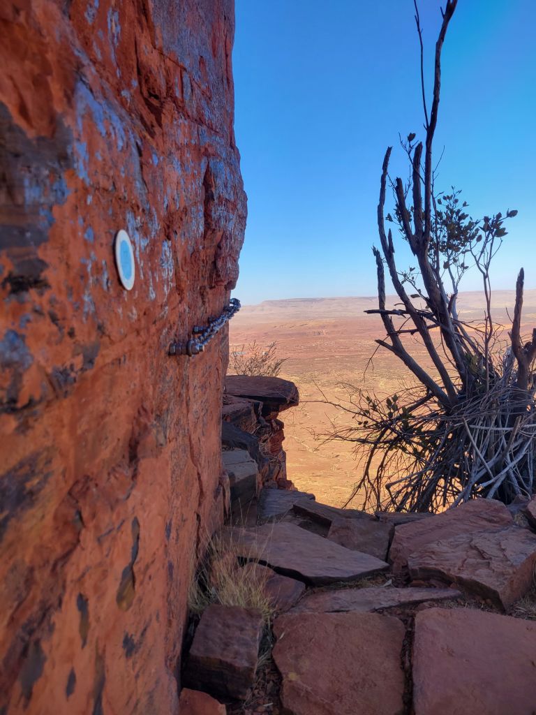


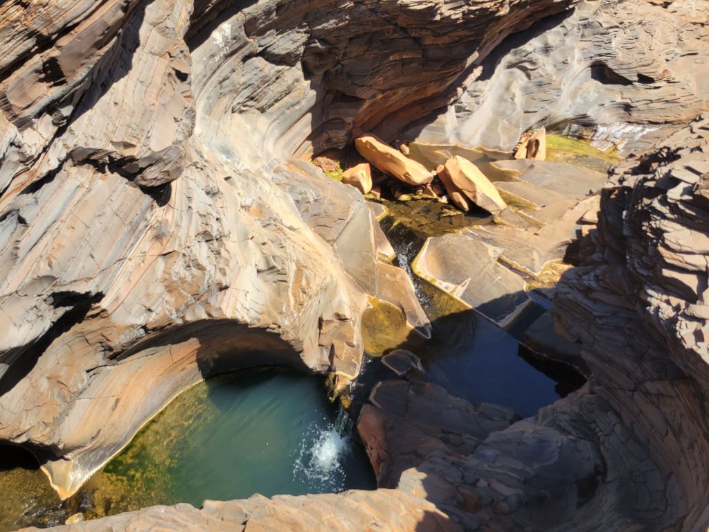
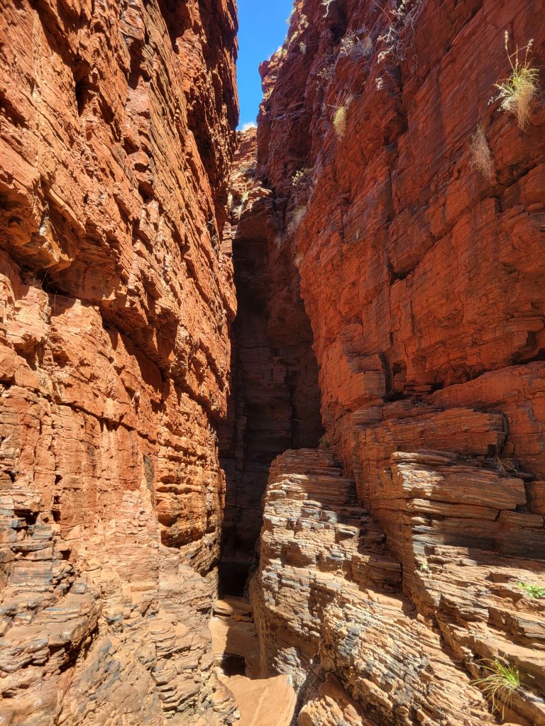
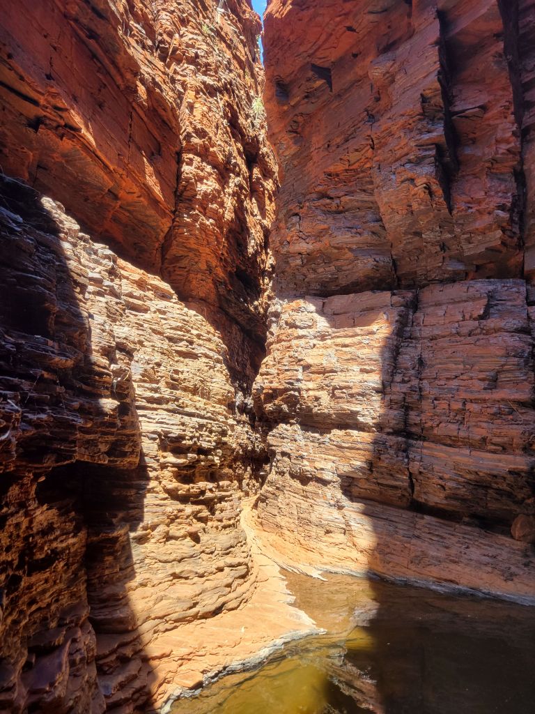
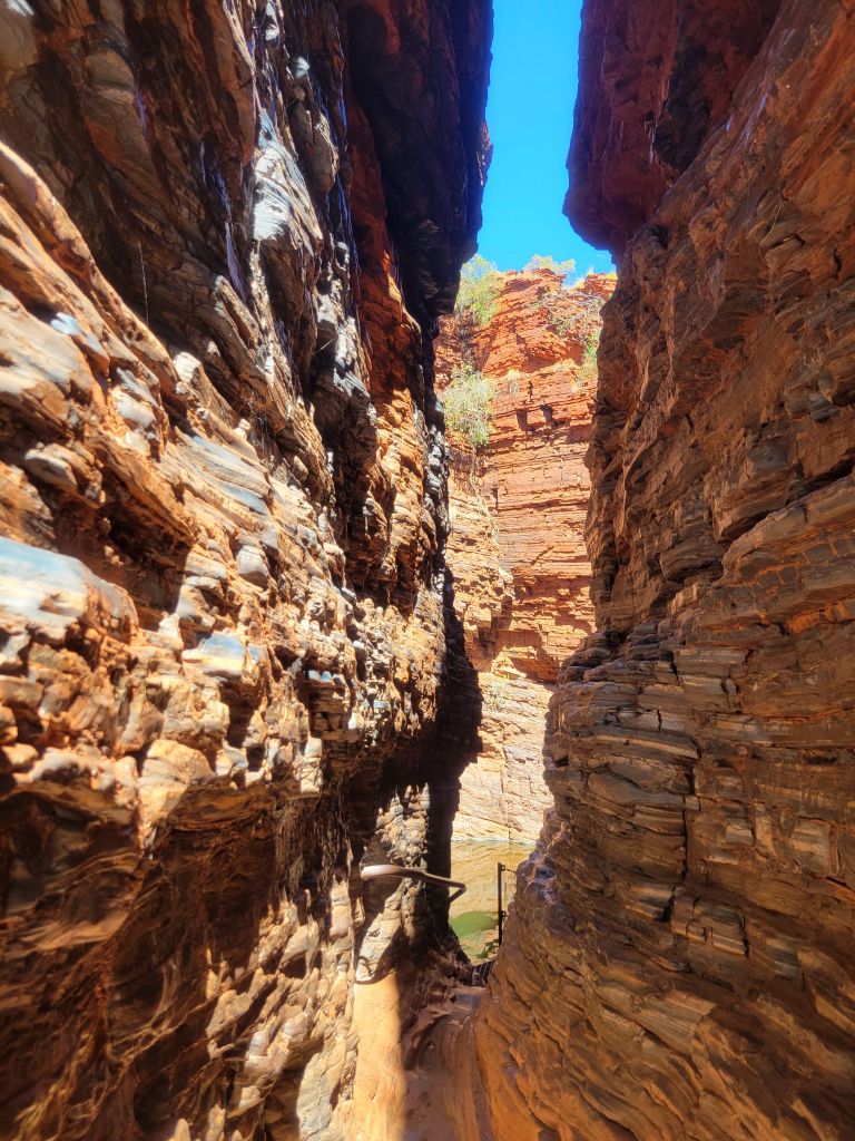
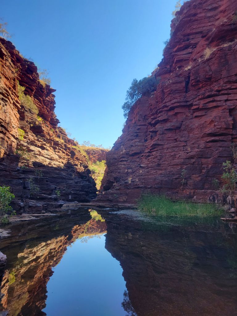
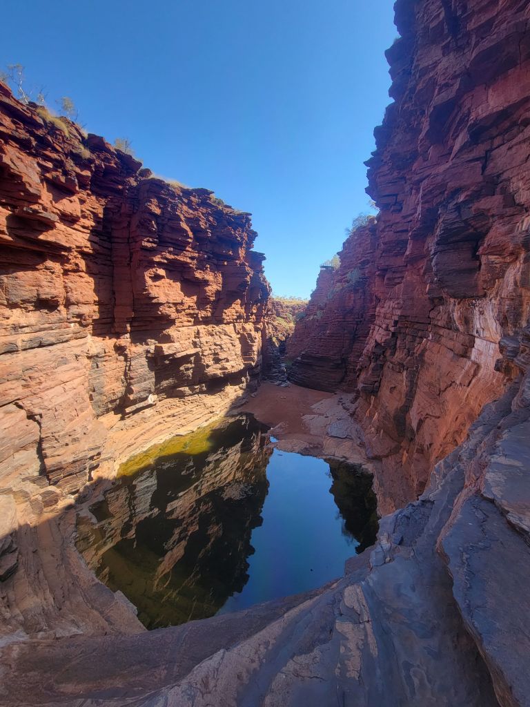
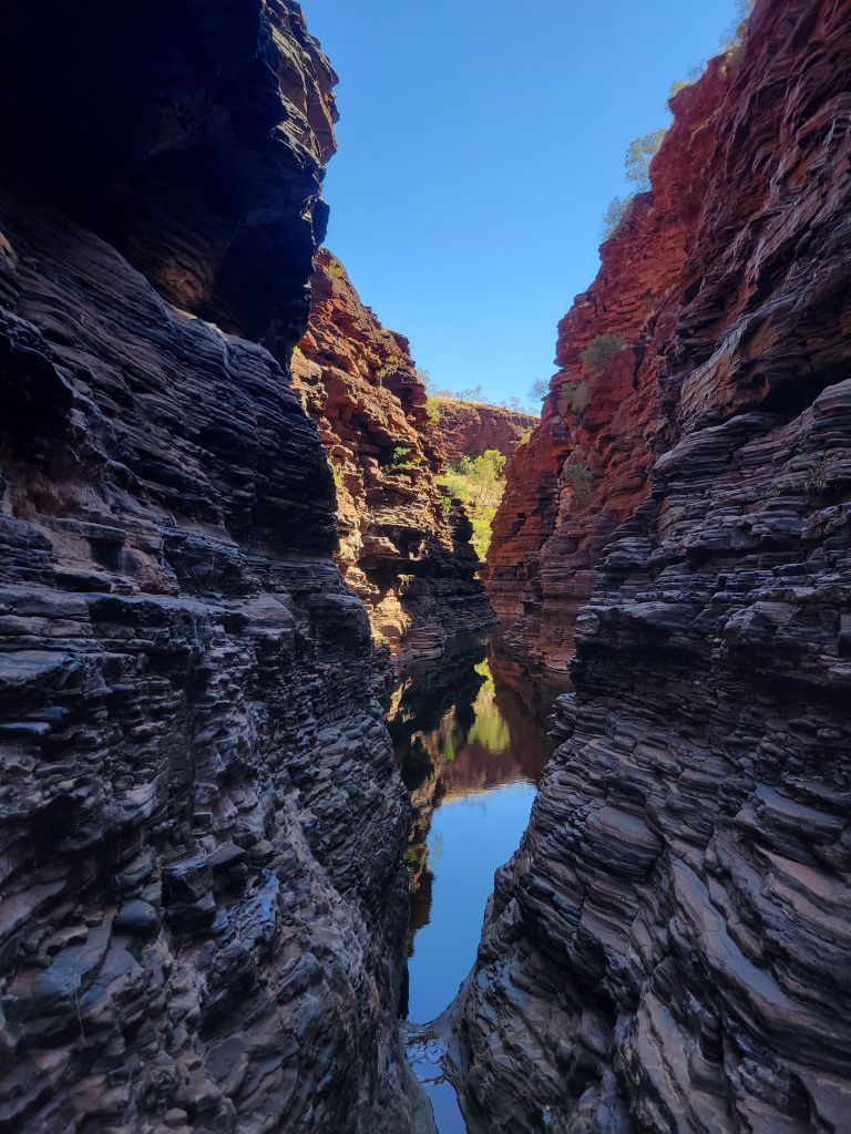
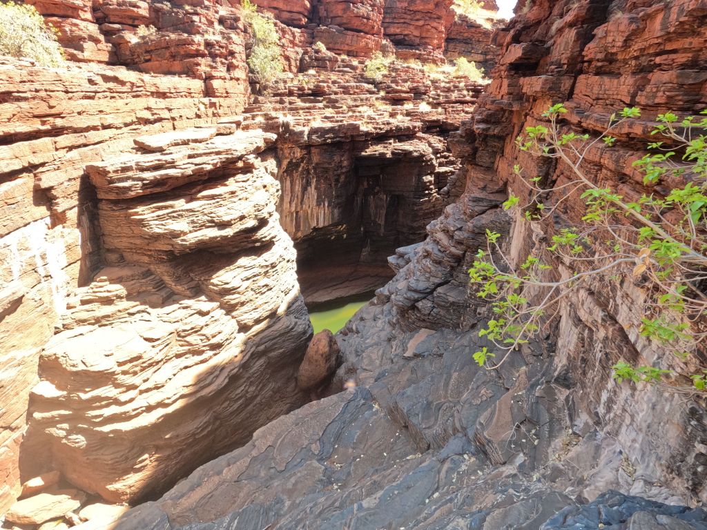
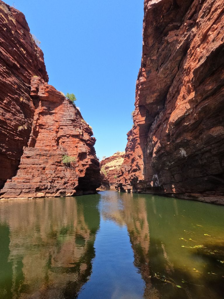
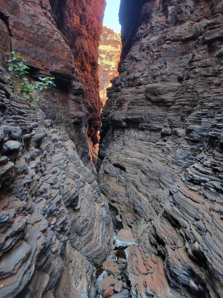
Since you have to get up early to beat the heat, after my 3 hours on Mt Bruce and a very lazy lunch it was still only around noon. The next destination was the Weano area, where there’s a lookout along with Weano and Hancock gorges. My first move was the Weano gorge loop, which lets you stroll through the scrub for a bit before descending into the gorge. The scrub is beautiful and the gorge is absolutely spectacular, with narrow passages opening up onto crystal clear green pools. The main attraction is handrail pool, imaginatively named for the handrail that helps you negotiate the steep and slippery rocks down. Thanks to reviews I’d read ahead of time I knew that you could actually swim across the pool and keep walking along the gorge for a bit, getting to another narrow pool that you also swim through, and ending up at a view of a narrow chute leading to a big drop down to a pool at the bottom of a 3 way intersection of gorges. I first got there around 2pm, with the sun still high enough that it cast a line of light across the various pools. It was, frankly, magical.


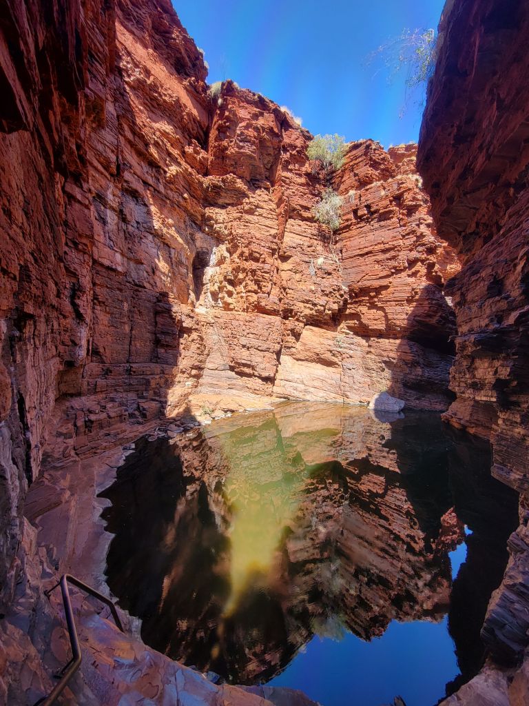


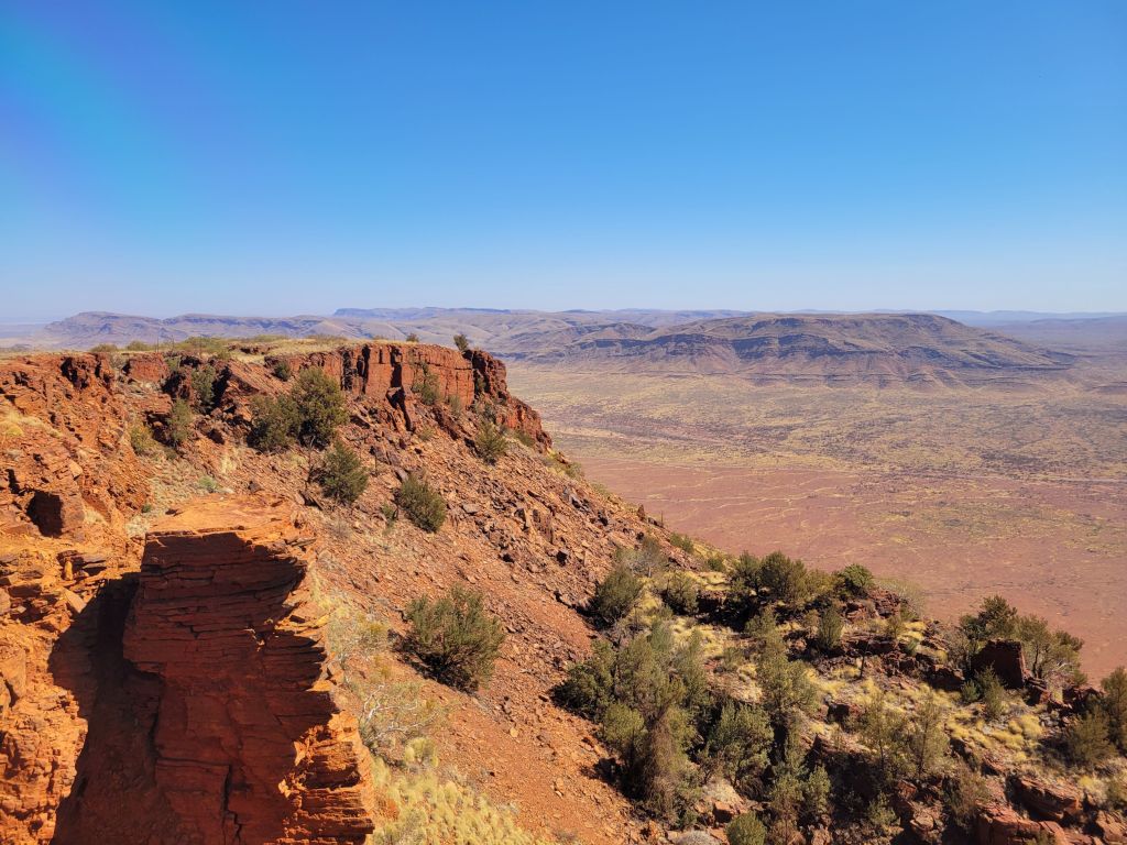
After two trips through handrail pool (I ran back to the van to get my gopro so I could take pictures of the other side) I moved on to the lookout. After being down in the gorge it was amazing to get a view from above of this red plateau covered in scrub with a few deep gashes cut into it. Finally, I crossed the road and checked out Hancock gorge. I’m going to be honest with you here—I’m pretty sure it was beautiful, and the pictures look quite nice, but at this point it had been a very long day and I just don’t really remember it that well!


I spent the night at the Karijini Eco Retreat, which in spite of the fancy name was only $22 per night given offseason pricing. This was well worth it for the water alone—with temperatures right around 100 every day (and it feeling much hotter than that in the sun), I was probably drinking somewhere around 8 liters, or 2 gallons, of water per day. The only other water source in the park is at the visitor center, it’s untreated, and I don’t have any purification equipment besides boiling, which would be a real last resort. At the eco retreat the water is all potable and they’re fine with you filling up water bottles as long as you don’t fill your van tanks, which I’d say is fair. I must have gotten more than 5 liters from them, which was the perfect amount to tide me over for my time in the park.
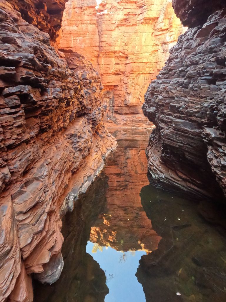
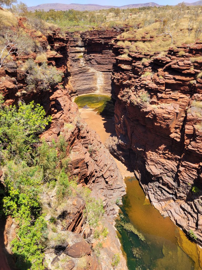
The next morning I started with Joffre gorge, which you can walk to right from the campsite. It was a nice quick stroll through the scrub before lots and lots of stairs to get down to the bottom of the gorge. With the weather heating up it’s the offseason now, and man am I grateful for that. I never saw more than a handful of people anywhere I went, and on this morning I had Joffre gorge entirely to myself. It wouldn’t be any kind of exaggeration to say that sitting in this beautiful space all by myself was a spiritual experience.
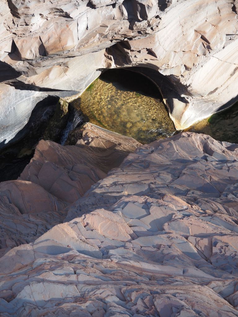
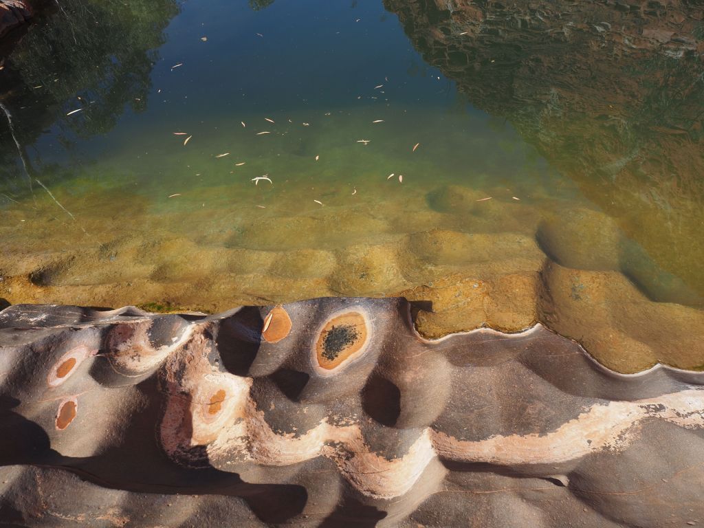
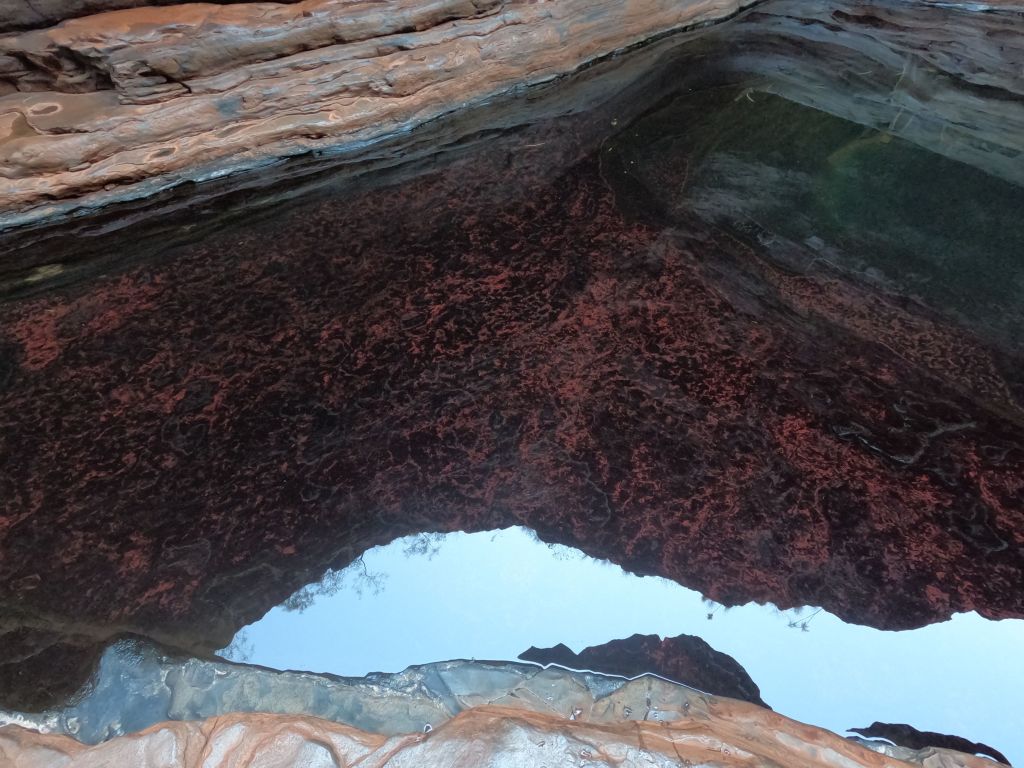
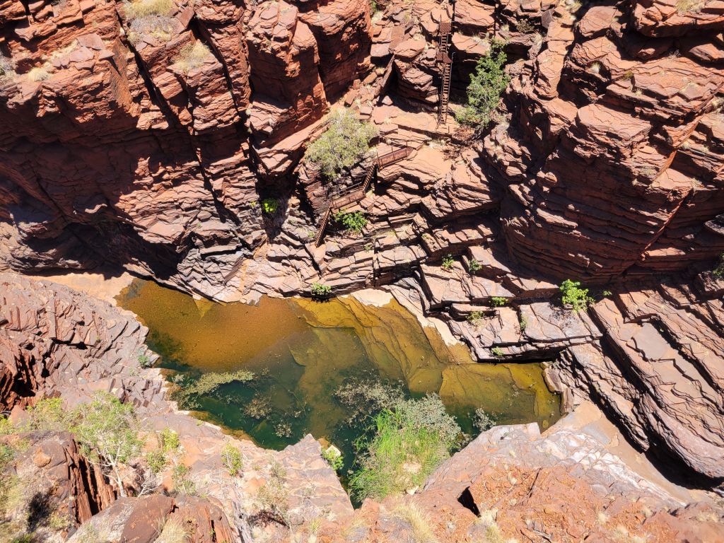
The stairs let you down to a first spot with a large pool. To the right is the main attraction, the amphitheater. When there’s been rain there’s a waterfall, but currently it’s just an enormous bowl of beautiful stripey rock with a pool at the bottom. After clambering around and checking out different views for a while I headed back the other way. Skirting the first pool and going the opposite way, a short rock scramble leads to a very narrow passage where the only option is to swim. The water filled the gorge past the next bend so I couldn’t tell how far the swim was, but luckily this time I’d at least come prepared with my gopro. The previous day’s experience told me my personal preference was to swim with my shoes on—everything dries insanely fast when it’s 100 degrees and bone dry, and shoes are more comfortable on pointy rocks and less slippery on smooth rocks than bare feet. So I dropped my pack, stripped down to my shorts, put my gopro in my pocket, and got in the water.
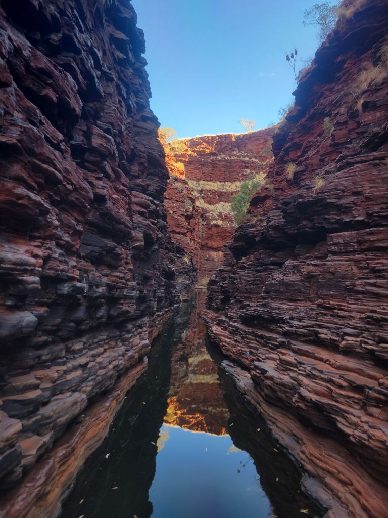
The swim turned out to be pretty long, 10 minutes of casual breast stroke in each direction. It was a pretty incredible feeling (and you don’t need to worry now knowing that I made it out alive) to just keep swimming through this incredible landscape, completely alone, not knowing where it was leading. The walls of the gorge widened, narrowed, and widened again, and eventually I got to a large pool that gave onto a wide expanse of dry land. After a bit of gravel I got to a section which was just huge pieces of the stripey rock that makes up the gorge, all broken along the layers that they’re made up of, each sort of reminiscent of a boxy stack of pancakes. After scrambling over and around them I got to another massive amphitheater which funneled down to a thin waterfall with a huge boulder wedged into it, and then a long drop to another pool farther down. It was stunning.
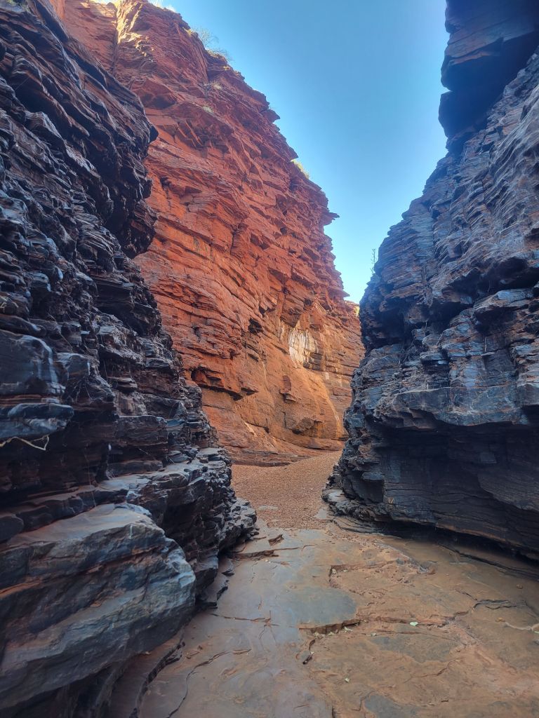


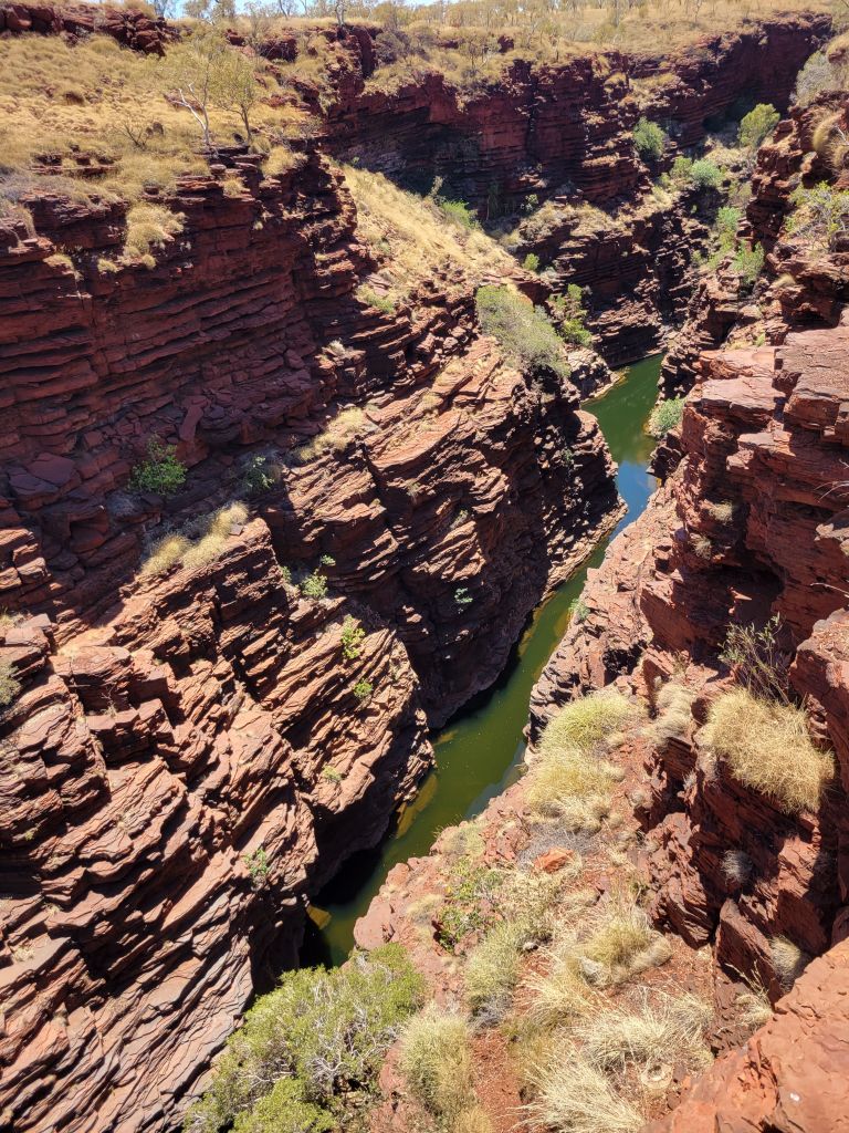

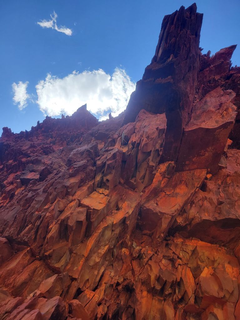
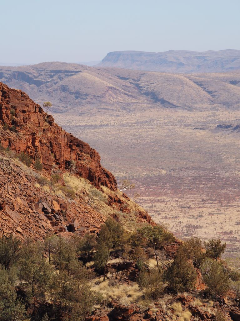
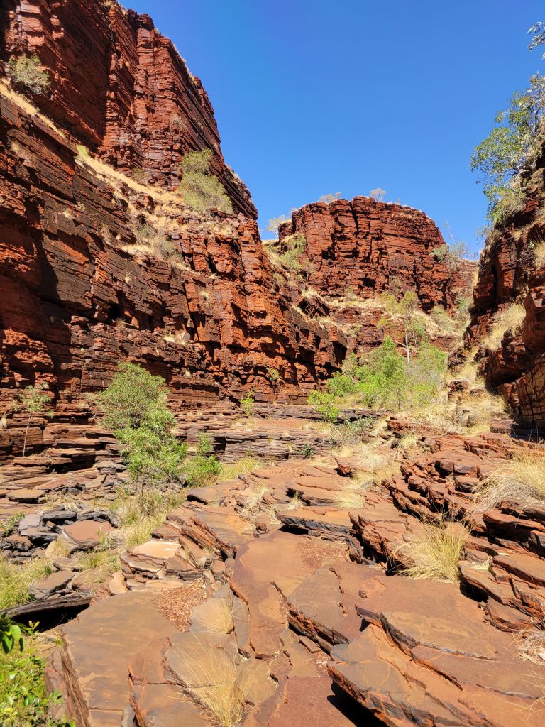
After all that exploration I had some lunch and then looped around to check out the viewpoint on the other side of Joffre gorge. Once again, the shift in perspective to see the place I’d just been exploring from above was extremely cool, giving a whole different sense of scale. Then I continued down the road to Knox gorge. The descent into Knox is, rather than a staircase, an actual, honest to god, rock and dirt trail, so of course the many Aussie safety signs warn of the incredible difficulty. After the trip down I again explored as much of the gorge as I could. I was able to stay dry this time but got to walk a fair way down the gorge, eventually getting to the Aussie safety stop sign and cordon, which was fair enough since at that point continuing would have meant going down a steep, narrow chute which led to a sheer drop and a pool a long ways below. The towering walls of the gorge are all bright red, right angled-rocks, and the effect is spectacular.


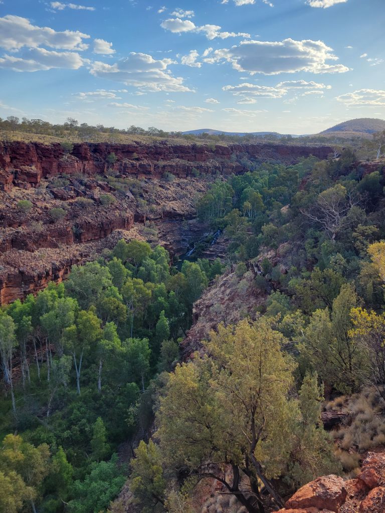
This wrapped up all the gorges I could get to on the west side of the park so I hopped in the van and headed for the east. The east side of the park has the visitor center (closed when I was there unfortunately), and the Dales’, both gorge and campground. I was pretty tired by this point but it was only around 4:30pm, and the thing about Karijini is that sitting around in the heat in your van at the campsite is way less comfortable than going down to the cool gorge. I initially planned to just go down and have a dip, but ultimately I caught a second wind and went for the loop walk of Dale’s gorge.
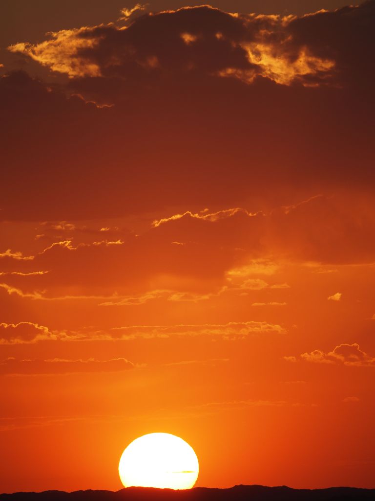
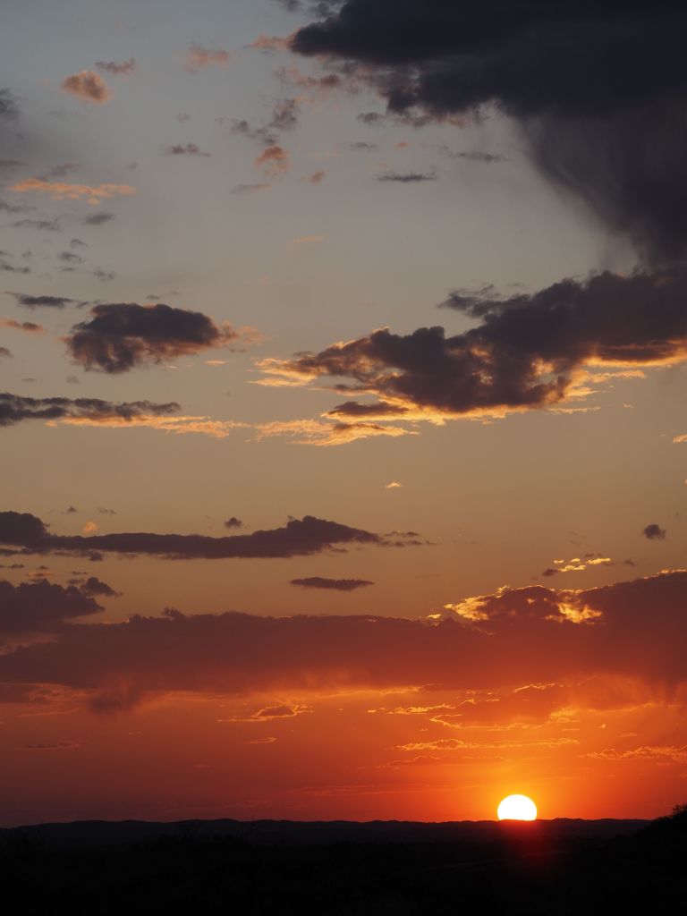
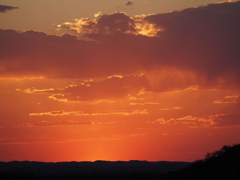
Dale’s seems to be the more popular one, unsurprising given its accessibility and proximity to the huge campground. The way down is just a series of stairs and boardwalks, and gets you to beautiful Fortescue falls. A short stroll to the right leads to shady Fern pool, where everyone was hanging out hiding from the heat. After Fern pool I turned back and headed down the gorge. Dale’s is one of the bigger gorges, quite wide at the bottom, and seems to have more water, so that the whole thing is full of trees and grass. The walk criss crosses the water a few times before getting to a staircase back up to the rim. From there I checked out the circular pool lookout, which was absolutely spectacular. Finally, with the sun setting, I strolled back to my van along the rim of the gorge, enjoying the changing colors of the red rocks and the mercifully lowering temperature.


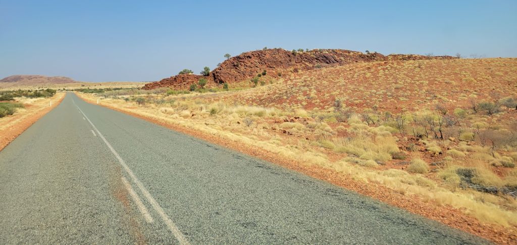
The next morning I went for a quick dip at Fern pool and then said my goodbyes to Karijini. It’s a short drive to the next town, a mining outpost called Tom Price, apparently after an American geologist who helped them realize how rich the area was in minerals (hurray…). Mines aside, the area is absolutely stunning, and just looking around from town gives great views of the surrounding hills. I was feeling pretty tired and puttered around for a while, getting coffee and lunch, grocery shopping, and filling up on water. By mid-afternoon there was nothing left to do but head on down the road.
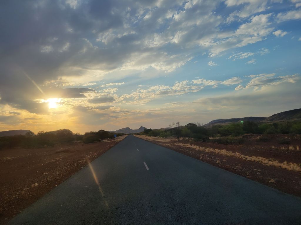
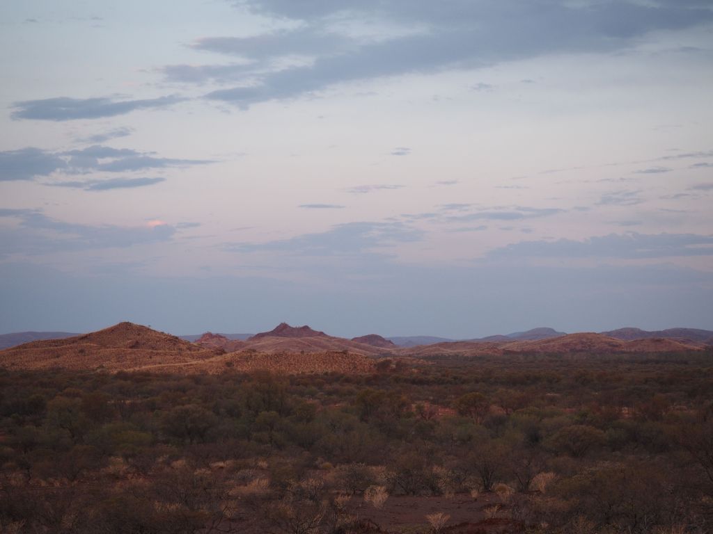
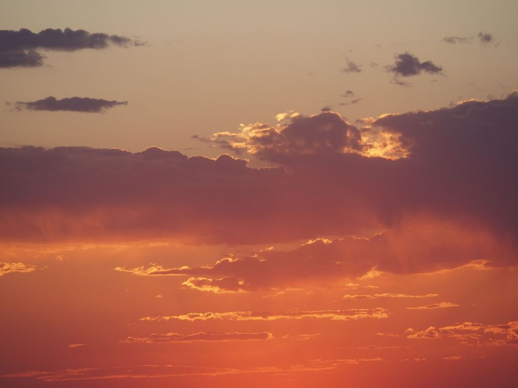
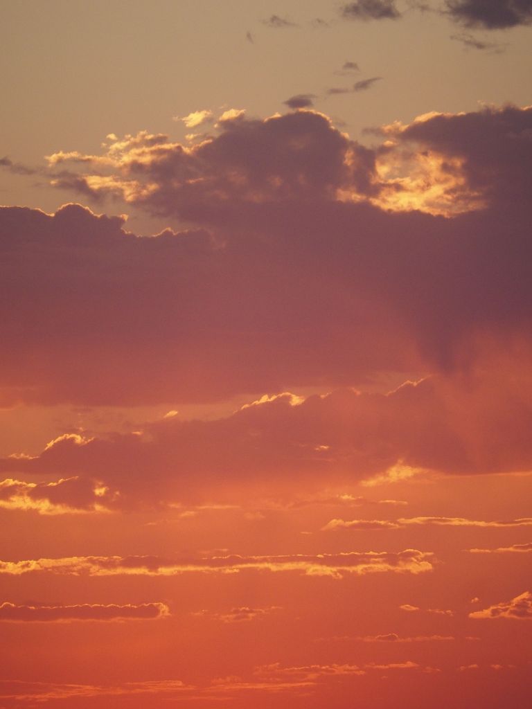
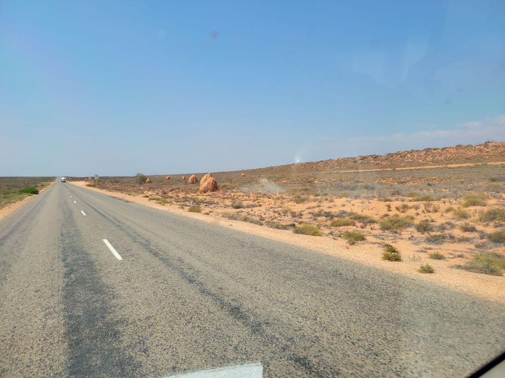
This region is called the Pilbara, and I have to say, it is absolutely spectacular. Several people had told me about the Kimberley, which is the very northern region of WA, and it certainly is beautiful up there. After today’s drive from Karijini, through Tom Price and Paraburdoo, I have to say I think the Pilbara gives it a run for its money. It didn’t hurt that today was the rare cloudy day, making the light play on the various rolling hills and mountains, but man I spent the whole drive to my campsite tonight just yelling “It is SO beautiful out here!”. I’m not sure when I’ll come back to Australia, but if I do you can bet that it’ll be to tour around WA in a 4 wheel drive. This is my kind of place.


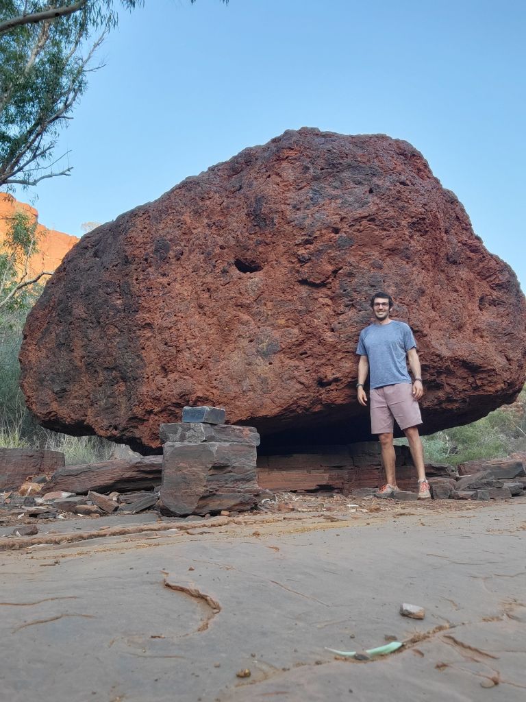
Stunning! I must say I love the ‘Big Rock’ standing by the ‘Bigger Rock’! Rock on Phil – what a beautiful journey you’re on!
LikeLike